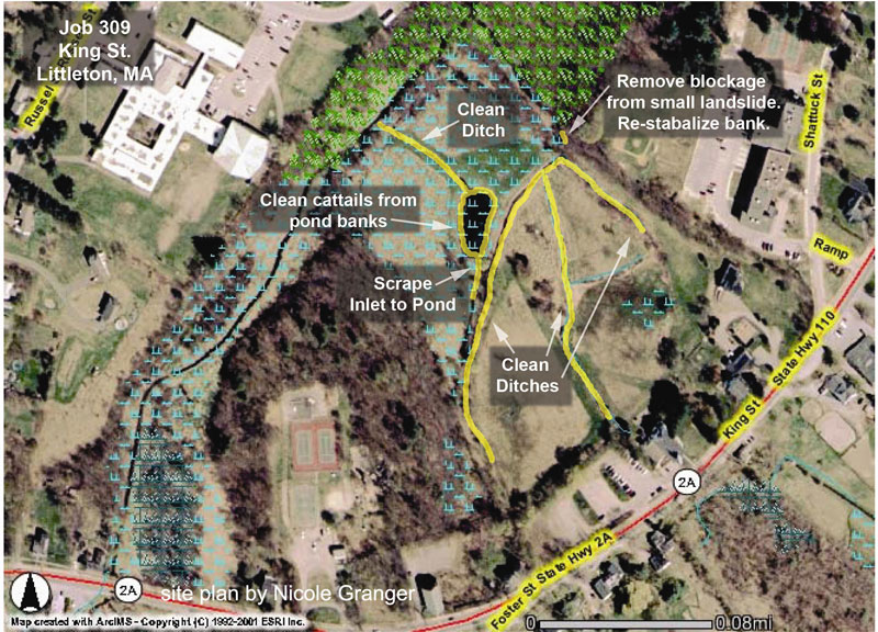
Site Plan
Restoration Guidelines
A survey to establish preexisting site conditions and plan of proposed ditch maintenance activities.
- Cause and effect: A brief narrative description of the cause and effect of the problem or potential problem associated with the need for the ditch maintenance project.
- Site map: A copy of an assessors, topographical, and/or aerial photograph indicating area of proposed ditch maintenance, access and egress.
- Photographic record: Documentation of the existing condition will be made using digital photography. The restored condition will also be documented several months after maintenance has been performed for a complete project record.
- Existing ditch profile: Field survey will be performed to provide a representative cross section of the existing ditch.
- Historical ditch profile: Soil cores and field observations will be used, along with any existing plans of the ditch to determine the historical ditch profile, including length, depth, width and placement of spoil deposits.
- Site plan profile: A profile of the planned ditch maintenance project including length, depth, width, and cubic feet of spoil displaced.
- Wetland type: A brief general description such as, Maple swamp, low branch swamp, grassy swamp, etc.
- Sediment loads: Water samples may be taken to determine the suspended sediment loads prior to, during, and post maintenance.
- Stream velocity: The stream velocity may be measured and recorded to determine the rate of flow when possible.
- Soil profile: Soil cores may be tested for composition to determine the ratio of granular to cohesive soils. Soils also may be used to identify hydric soils in order to delineate wetland boundaries according to USACE and state methodologies.