Epi Week #29 - 2016 General Statements
Submissions were down by about 17% this past week, but still above what they have been in past years during Epi Week 29, even with continued drought conditions. For this past week, the bump is likely linked to DPH surveillance in several towns and cities across the state (including Boston, New Bedford and Worcester) that brought in large numbers of both Culex pipiens/restuans and Coquillettidia perturbans. Several of the mosquito control projects/districts with coastal habitat observed a rise in population levels of saltmarsh species over the past week. Culiseta melanura levels were up slightly but still low, with only 539 specimens submitted for testing (compared to 2012, a big year for EEE, where Epi Week 29 brought in almost 3000 specimens.
Weather
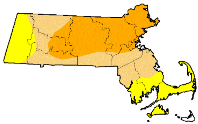
Drought conditions have worsened across much of the state again this past week, with a 6% increase in areas under Severe Drought status (orange) as D2 conditions expanded into the Boston area, northern Norfolk County, and southern Middlesex County attributed to an expansion into northern Bristol and Plymouth County.
Our weather expert at MDAR is predicting a brief break from the intense heat with storms coming through at the end of Epi Week 30 that may bring some relief to area south of the Mass Pike. However, temperatures are expected to rise back up into the 90s by the middle of Epi Week 31, with no other rain events in our near future.
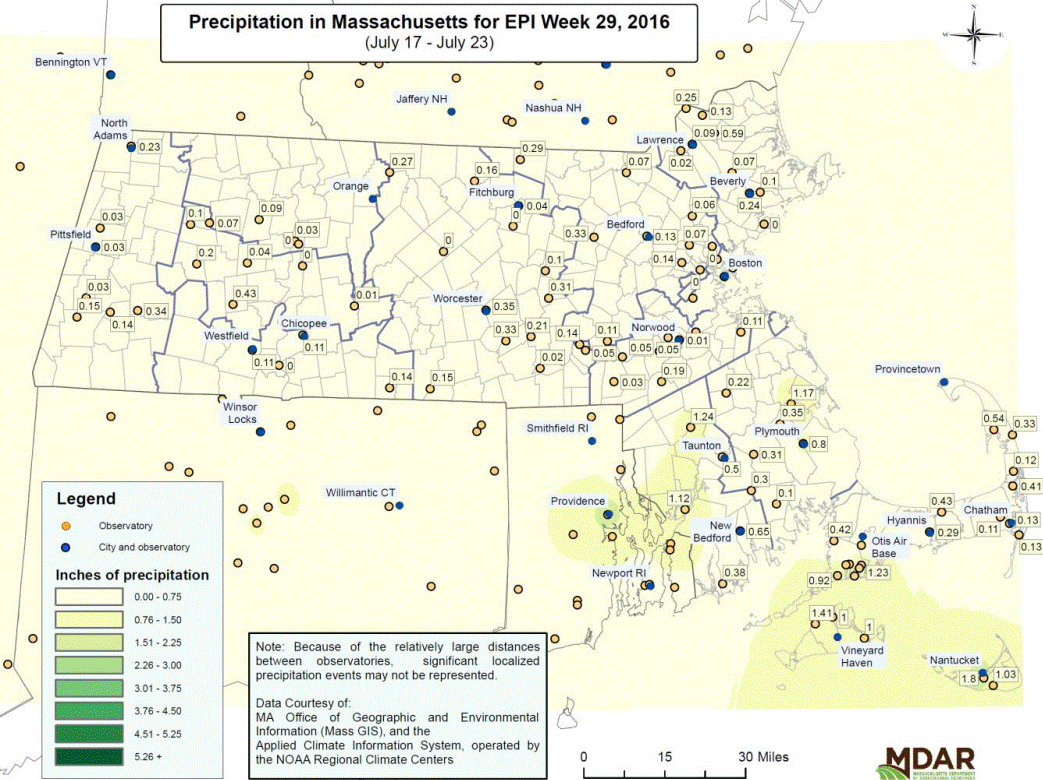
As you can see from the Epi Week 29 map below, the southeast part of the state received some rainfall, but the rest of the state mostly remained parched.