Epi Week #25 - 2015 General Statements
With recent rains, several projects saw an uptick in floodwater species such as Aedes vexans (not reflected in the graph below because few pools of that species were submitted for arbovirus testing). The general weather trend means that storms will continue to contribute to floodwater habitat, so expect those species to continue to be on the increase.
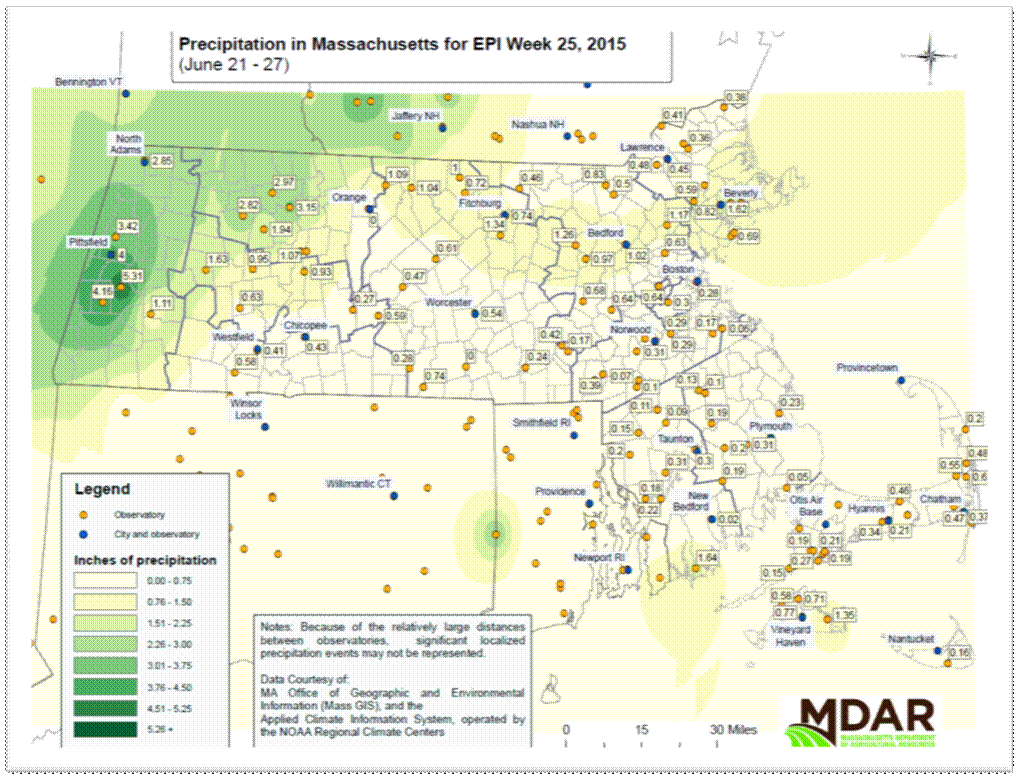
Weather
While May and most of June were mainly warm and dry for most of the state, warmer than normal Pacific ocean temperatures are now creating a massive ridge of high pressure in the western US, which in turn forces a downstream low pressure trough in the central/eastern US. The ‘battle-zone’ between the ridge and trough is where the axis of heavy precipitation will form, leading to two possible outcomes this summer:
- Strong west coast ridge + strong central U.S/east coast trough & no Bermuda high = Cold summer (very little heat/warmth, cloudy, cool, dank, very poor tomato harvest [lots of fungal blight]).
- Strong west coast ridge + weak central U.S trough + moderate Bermuda high = Warm humid summer with lots of storms (some severe).
Western MA continued to be an outlier with regard to precipitation levels this past week, with towns south of Pittsfield receiving as much as 5+ inches of rain. For the next week or so, expect no extreme heat, but no shockingly cool temperatures either. Most days and evenings will be at or a tad below normal (upper 70s for a high, upper 50s for overnight lows).