Epi Week #26 - 2015 General Statements
A lot of variation in weather conditions throughout the state means there is no real overall trend at this time, other than having no arbovirus found. Storm events continue to be in the forecast, and will continue to drive floodwater mosquito populations.
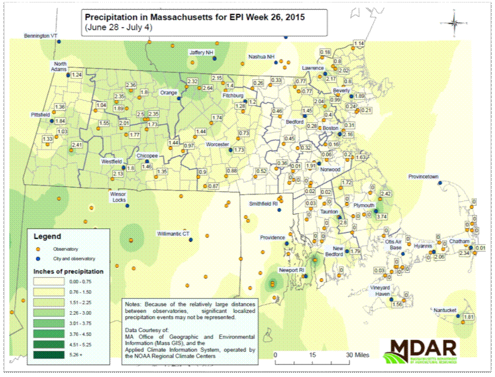
Weather
Our weather expert, Trevor Battle, noted that the month of June was highly variable temperature-wise, with Boston-area temperatures 3’F below normal, while the Worcester-area experienced temperatures close to average. He is predicting average or slightly below average temperatures during July and August, with no long-term heat waves but also no stretches of gloomy, chilly days. Unfortunately, there will be plenty of muggy nights, which means those 80’F days may feel worse than a dry heat wave. Precipitation is expected to be slightly above average, with much higher amounts of rainfall in Western MA. Despite the scattered weather events, much of the state remains in pre-drought conditions (D0, or Abnormally Dry), with the Cape and Islands and southernmost parts of Bristol and Plymouth County at D1 (Moderate Drought).
As the map on the next page shows, most of the state received some rain this past week. Localized rain events brought significant precipitation to a few areas in Bristol and Plymouth counties as well as Cape Cod. Western MA counties also received about 1-2” of rain, as did Essex and northeastern Middlesex counties.