
Epi Week #27 - 2017 General Statements
We have now had 3 WNV-positive mosquito pools in wide-ranging parts of Massachusetts (Suffolk, Berkshire, and Bristol Counties, indicating that this arbovirus is likely around at low levels throughout the state. It is still too early in the season to make predictions as to how this will impact potential human cases. However, EEEv predictions have panned out so far this season, with Culiseta melanura levels staying low despite repeated rain events.
Weather
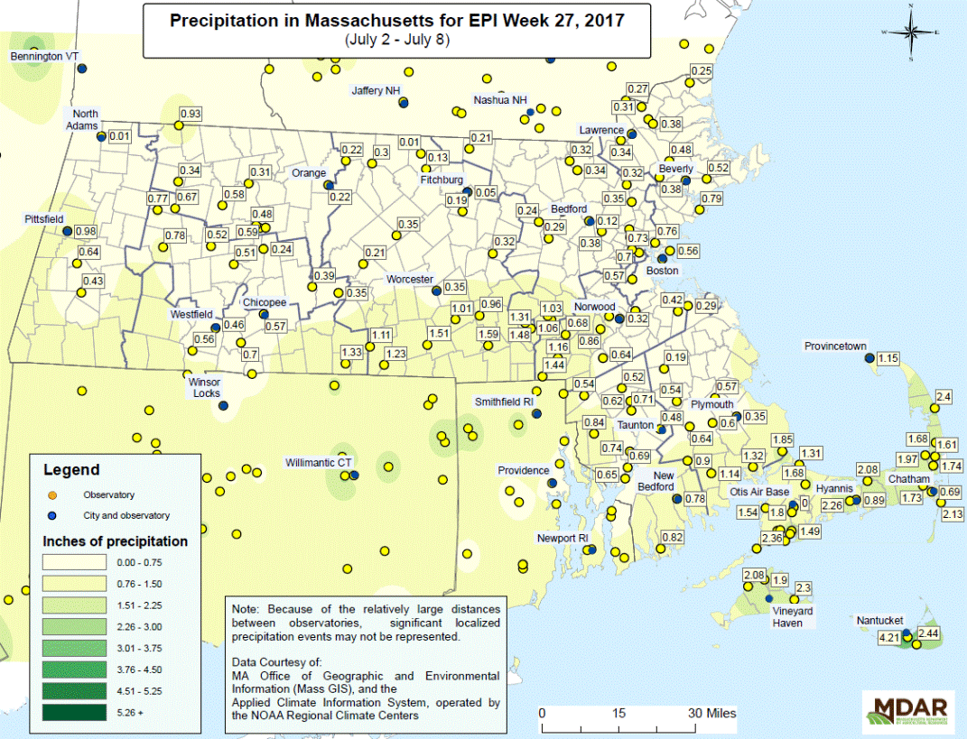
Precipitation was fairly limited for Epi Week 27, though most of the Cape and Islands received 2 inches or more and the southern edge of the state got as much as 1.5 inches in some areas. We are at the time of year when rain accumulation is dependent more on scattered storm events than big systems, which means that even within a county the precipitation amounts can vary greatly.
As this report goes to press (July 13), Ep Week 28 has already brought us two days of storm events, with flash flood warnings panning out in several parts of the state along with lightning, thunder, and hail. Looking into Epi Week 29, expect slightly below normal precipitation and temperatures that finally warm back up to the low to mid-80s, with a few days near or above 90F. Climatologically, the next two weeks are the hottest of the year, and we should not see cool, dreary weather like we had at the end of Epi Week 28 for a long time.